Live USGS Earthquake Map
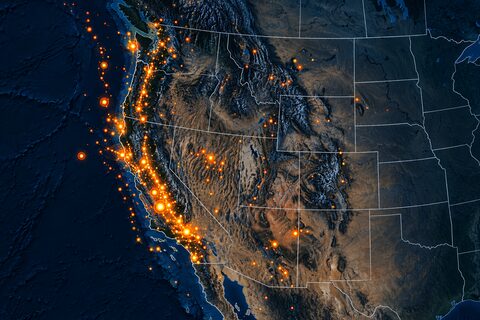
This graph fetches public GeoJSON from the USGS earthquake feed and returns it directly for Map Preview, Table, and JSON panels.
The graph shape is:
URL Input -> HTTP Request -> JSON Path -> JSON Response
Recommended panel bindings:
- Map Preview: bind to
Fetch earthquakes: json. - Data Table: bind to
Feature rows: value. - JSON Inspector: bind to
GeoJSON Response: responseorFetch earthquakes: json.
The default feed is:
https://earthquake.usgs.gov/earthquakes/feed/v1.0/summary/2.5_day.geojson
You can edit the USGS GeoJSON URL node to try other USGS feeds such as all-day, significant-week, or monthly feeds.
Known v0 caveat: the Map Preview understands GeoJSON Point features and simple rows with lat/lon fields. Lines, polygons, clustering, heatmaps, and richer basemap controls are future panel upgrades.